
Ausangate Mountain
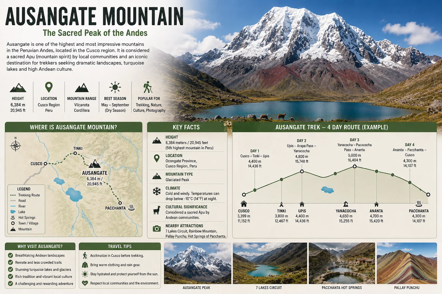
Ausangate Mountain is one of the highest and most important mountains in Peru. Rising to approximately 6,384 meters (20,945 feet) above sea level, this massive snow-covered peak dominates the Vilcanota mountain range southeast of Cusco.
Known locally as Apu Ausangate, the mountain has deep cultural and spiritual importance for Andean communities. It is also surrounded by some of southern Peru’s most impressive landscapes, including glaciers, turquoise lakes, high mountain passes, alpaca herds, and remote Quechua-speaking communities.
Travelers do not need to climb Ausangate Mountain to experience it. The multi-day Ausangate Trek circles through the surrounding mountains and provides spectacular views of the peak from several locations.
Where Is Ausangate Mountain?
Ausangate Mountain is located in the Vilcanota mountain range of the Cusco region, approximately 100 kilometers southeast of Cusco city.
The mountain lies within the province of Quispicanchi and forms part of a remote high-Andean environment.
Towns and communities commonly associated with access to the Ausangate region include:
-
Tinki
-
Ocongate
-
Upis
-
Pacchanta
Tinki is one of the traditional gateways for trekking routes around the mountain.
From Cusco, reaching the region requires traveling southeast through the Andes before continuing toward the trailheads surrounding Ausangate.
How High Is Ausangate Mountain?
Ausangate Mountain reaches approximately 6,384 meters (20,945 feet) above sea level.
This makes it one of the highest mountains in Peru and one of the dominant peaks of the Vilcanota range.
| Location | Approximate Elevation |
|---|---|
| Cusco | 3,400 m / 11,155 ft |
| Tinki | 3,800 m / 12,467 ft |
| Pacchanta | 4,200 m / 13,780 ft |
| Ausangate Trek camps | 4,300–4,700 m / 14,108–15,420 ft |
| High trekking passes | 4,800–5,200 m / 15,748–17,060 ft |
| Ausangate Summit | 6,384 m / 20,945 ft |
Although trekkers do not reach the summit, the surrounding trails still operate at extremely high elevations.
Our guide to the Ausangate Trek altitude explains the elevations encountered while hiking around the mountain.
Is Ausangate the Highest Mountain in Peru?
No.
The highest mountain in Peru is Huascarán, which reaches approximately 6,768 meters (22,205 feet) in the Cordillera Blanca.
Ausangate is lower than Huascarán but remains among Peru’s highest peaks.
It is also the highest mountain in the Cusco region.
Its enormous elevation and isolated position make Ausangate visible from several areas of the surrounding Andes.
What Does Ausangate Mean?
The exact linguistic origin and interpretation of the name Ausangate is not universally agreed upon.
More important locally is the mountain’s identity as an Apu.
In Andean tradition, an Apu is a sacred mountain associated with protection, spiritual power, and the surrounding territory.
Ausangate is considered one of the most important sacred mountains in southern Peru.
For communities living around the mountain, Ausangate is therefore much more than a geographical landmark.
Why Is Ausangate Sacred?
Mountains have held spiritual importance in the Andes for centuries.
In traditional Andean belief, powerful mountains are considered Apus, protective beings connected with communities, animals, water, weather, and the fertility of the land.
Ausangate is among the most significant Apus in the Cusco region.
Communities surrounding the mountain continue to maintain traditions connected with the landscape, agriculture, alpaca herding, and offerings to Pachamama and the mountains.
This cultural relationship is an important part of understanding the Ausangate region.
The mountain should not be viewed only as a trekking destination but as part of a living cultural landscape.
What Does Ausangate Mountain Look Like?
Ausangate is a massive glaciated mountain surrounded by several peaks and high-altitude valleys.
Its landscape includes:
-
Snow-covered summits
-
Glaciers
-
Steep mountain walls
-
Turquoise glacial lakes
-
High-Andean grasslands
-
Rocky mountain passes
The appearance of the mountain changes considerably depending on where you view it from.
From some sections of the trek, Ausangate appears as a distant snow-covered massif.
From locations such as Upis and the surrounding high valleys, the glaciers and mountain walls can feel much closer.
Ausangate Mountain Glaciers
Ausangate contains extensive glaciated terrain.
These glaciers contribute to the dramatic appearance of the mountain and help feed streams and high-altitude lakes throughout the surrounding region.
Several lakes along the trekking routes display striking turquoise, blue, or green colors.
The combination of:
white glaciers + turquoise lakes + brown and red mountains + high-Andean grasslands
is one of the defining visual characteristics of the Ausangate region.
Glacial environments are sensitive to changes in temperature and climate, making the landscape around Ausangate dynamic rather than permanent.
Can You Visit Ausangate Mountain?
Yes, but “visiting Ausangate” usually means exploring the region surrounding the mountain, not climbing to its summit.
There are several ways to experience the area.
Ausangate Trek
The multi-day Ausangate Trek is the most complete way to explore the mountain.
Depending on the itinerary, trekkers spend approximately 4–6 days crossing valleys, lakes, and high mountain passes around the massif.
Ausangate 7 Lakes
Travelers who do not want to complete a multi-day trek can visit the 7 Lakes of Ausangate near Pacchanta.
This provides an opportunity to see glacial lakes and mountain scenery during a shorter excursion.
Pacchanta
Pacchanta is a small Andean community known for its views of the Ausangate region and natural hot springs.
It is also an important starting or finishing point for several hiking routes.
Mountaineering
Climbing the actual summit of Ausangate is completely different from trekking around it.
A summit attempt requires technical mountaineering experience, specialized equipment, glacier travel skills, and appropriate expedition support.
Ausangate Mountain vs Ausangate Trek
These terms are often used together, but they do not mean the same thing.
Ausangate Mountain is the 6,384-meter snow-covered peak.
The Ausangate Trek is a multi-day hiking route through the surrounding Vilcanota mountain range.
| Ausangate Mountain | Ausangate Trek |
|---|---|
| Mountain peak | Multi-day hiking route |
| 6,384 m / 20,945 ft | Passes around 5,000+ m |
| Technical climbing to summit | No technical climbing on standard trek |
| Mountaineering experience required | Hiking experience recommended |
| Specialized expedition | Trekking route |
Most international travelers visiting Ausangate are trekking around the mountain rather than climbing it.
How Long Is the Ausangate Trek?
There is no single standardized route.
Common itineraries include:
-
4 days
-
5 days
-
6 days
-
Longer variations
-
Ausangate + Rainbow Mountain
Depending on the itinerary, routes commonly cover approximately 40–70+ kilometers.
Our Ausangate Trek Distance guide compares the distances of the 4-, 5-, and 6-day routes.
If you are deciding between the two most common options, our Ausangate Trek 4 Days vs 5 Days comparison explains the main differences.
What Can You See Around Ausangate Mountain?
The mountain itself is only one part of the landscape.
Travelers exploring the region can encounter:
Glacial Lakes
Numerous lakes surround the Ausangate massif.
Their colors range from deep blue to turquoise and green depending on minerals, sediments, depth, and lighting conditions.
Alpacas and Llamas
The Ausangate region is one of Peru’s important alpaca-herding areas.
Large herds can often be seen grazing across the high-altitude grasslands.
Remote Andean Communities
Small communities remain scattered throughout the region.
Many families continue traditional livestock-based lifestyles adapted to the extreme high-Andean environment.
Mountain Passes
Multi-day trekking routes cross several passes approaching or exceeding 5,000 meters.
These high points provide expansive views across the Vilcanota range.
Hot Springs
Natural thermal waters can be found around locations such as Upis and Pacchanta.
They are particularly popular after long days of hiking.
Ausangate Mountain and Rainbow Mountain
Ausangate and Vinicunca Rainbow Mountain are located within the broader high-Andean landscape southeast of Cusco.
Some longer trekking itineraries combine the Ausangate circuit with Rainbow Mountain.
However, they are separate attractions.
Ausangate is a massive snow-covered mountain and glacial system, while Vinicunca is famous for its colorful mineral layers.
Travelers can visit Rainbow Mountain as a day trip from Cusco without completing the Ausangate Trek.
Ausangate Mountain and the 7 Lakes
The 7 Lakes of Ausangate are located near Pacchanta and provide one of the easiest ways to experience the landscape surrounding the mountain without completing the full circuit.
The hike passes several glacial lakes beneath the surrounding peaks.
Because the excursion starts from Pacchanta, visitors can also combine the hike with the area’s hot springs.
The route still reaches significant elevation, so proper acclimatization is important.
How Difficult Is Hiking Around Ausangate?
The standard Ausangate Trek does not normally require technical climbing.
However, it is considered challenging because of:
-
High altitude
-
Multiple mountain passes
-
Cold temperatures
-
Remote terrain
-
Consecutive hiking days
-
Changing mountain weather
Much of the trail remains above 4,000 meters.
The Ausangate Trek Difficulty guide provides a complete breakdown of fitness requirements, altitude, terrain, and daily hiking demands.
Best Time to Visit Ausangate Mountain
The dry season from approximately May through September generally provides the most favorable trekking conditions.
During these months, travelers can expect a greater probability of:
-
Clear mountain views
-
Lower rainfall
-
Drier trails
-
Stable trekking conditions
However, nighttime temperatures can become extremely cold.
June and July are particularly known for cold nights at high elevation.
The rainy season generally runs from approximately December through March and can bring clouds, rain, snow, hail, and muddy trails.
For a month-by-month breakdown, see our guide to the best time to hike the Ausangate Trek.
How to Get to Ausangate Mountain from Cusco
Most journeys into the Ausangate region begin in Cusco.
The general route travels southeast toward Urcos and Ocongate before continuing toward communities such as Tinki or Pacchanta.
The exact route depends on the activity.
Multi-day treks may begin near Tinki or Upis, while travelers visiting the 7 Lakes generally continue toward Pacchanta.
There is no road that takes ordinary visitors directly to Ausangate Mountain itself.
The final sections of the region are explored on foot.
Do You Need to Acclimatize?
Yes.
Even if you are not climbing Ausangate Mountain, the surrounding attractions are located at very high elevation.
Cusco itself sits at approximately 3,400 meters, while many Ausangate trekking sections exceed 4,500 meters.
Travelers arriving from low elevation should generally spend at least a few days acclimatizing before beginning a demanding hike in the region.
Physical fitness does not prevent altitude sickness.
If you plan to complete the circuit, our guide on how to prepare for the Ausangate Trek covers training and acclimatization before departure.
What to Bring to Ausangate
Equipment depends on whether you are completing a day hike or multi-day trek.
For longer routes, important items include:
-
Warm layers
-
Waterproof jacket
-
Hiking boots
-
Thermal clothing
-
Gloves
-
Warm hat
-
Sunglasses
-
Sunscreen
-
Trekking poles
-
Water
-
Sleeping equipment
Weather can change quickly at these elevations.
Our complete Ausangate Trek Packing List covers the equipment required for multi-day trekking.
Is Ausangate Mountain Worth Visiting?
Yes, particularly for travelers interested in high-altitude landscapes and trekking away from Peru’s busiest tourist routes.
The region combines:
glaciers + turquoise lakes + snow-covered mountains + alpaca herds + traditional communities + high mountain passes.
Unlike Machu Picchu or Rainbow Mountain, the Ausangate circuit is not centered around one viewpoint.
The landscape changes continuously as you move around the massif.
That makes Ausangate particularly appealing to travelers who want the journey itself to be the main experience.
Frequently Asked Questions
Where is Ausangate Mountain?
Ausangate Mountain is located in the Vilcanota mountain range southeast of Cusco, Peru.
How high is Ausangate Mountain?
Ausangate reaches approximately 6,384 meters (20,945 feet) above sea level.
Is Ausangate the highest mountain in Peru?
No. Huascarán is Peru’s highest mountain. Ausangate is, however, the highest mountain in the Cusco region.
Is Ausangate Mountain the same as Rainbow Mountain?
No. Ausangate is a snow-covered glaciated mountain, while Vinicunca is the colorful mountain commonly known as Rainbow Mountain.
Can beginners visit Ausangate?
Beginners can visit parts of the Ausangate region and properly prepared hikers can attempt the multi-day trek. Climbing the actual summit is a technical mountaineering objective and is completely different from trekking.
Can you see Ausangate without doing the trek?
Yes. The mountain can be seen from several locations in the surrounding region. Pacchanta and the Ausangate 7 Lakes route provide options for travelers who do not want to complete the multi-day circuit.
How many days do you need for Ausangate?
The classic trekking experience generally requires around 4–6 days, although shorter day hikes and longer trekking variations are available.
Is Ausangate Mountain sacred?
Yes. Ausangate is considered an important Apu, or sacred mountain, by Andean communities in the Cusco region.
Can you climb Ausangate Mountain?
Yes, but climbing the summit is a technical mountaineering expedition involving glaciers, extreme altitude, specialized equipment, and significantly greater risks than the standard Ausangate Trek.
Final Thoughts
Ausangate Mountain is much more than the backdrop to a trekking route.
At approximately 6,384 meters (20,945 feet), it is the highest mountain in the Cusco region and one of the great peaks of the Peruvian Andes.
Its glaciers feed high-altitude lakes and valleys where alpaca-herding communities have lived for generations, while its status as Apu Ausangate gives the mountain deep cultural importance within the Andean worldview.
Most travelers experience the mountain by trekking through the surrounding Vilcanota range rather than attempting its technical summit.
If you are planning that journey, start with the Ausangate Trek Map to understand the route, then review the Ausangate Trek altitude and Ausangate Trek Difficulty before deciding which itinerary is right for you.
Related Articles
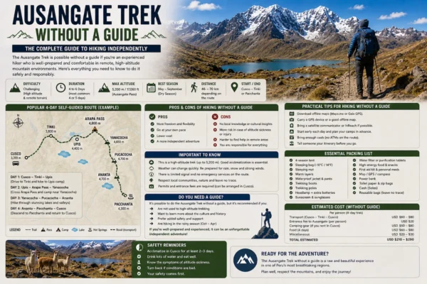
Ausangate Trek Without a Guide
Ausangate Trek Without a Guide Can you do the Ausangate Trek without a guide?…
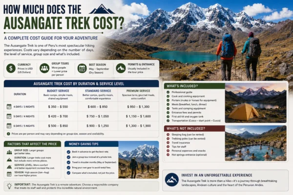
How Much Does the Ausangate Trek Cost?
How Much Does the Ausangate Trek Cost? The Ausangate Trek cost typically ranges from…
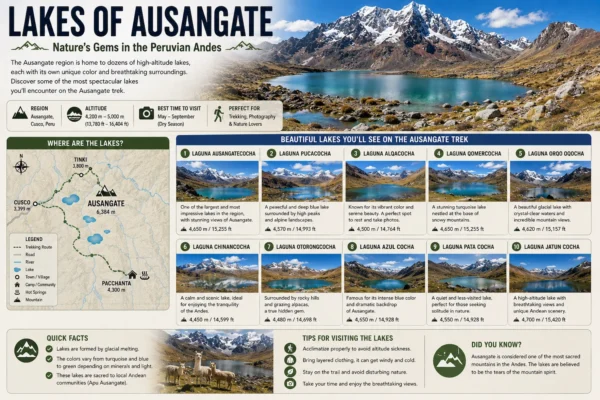
Lakes of Ausangate The Lakes of Ausangate are among the most spectacular natural features…
Wildlife on the Ausangate Trek
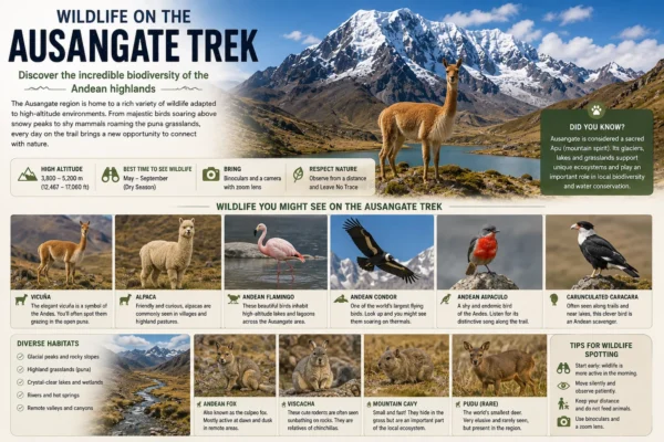
Wildlife on the Ausangate Trek The wildlife on the Ausangate Trek is adapted to…
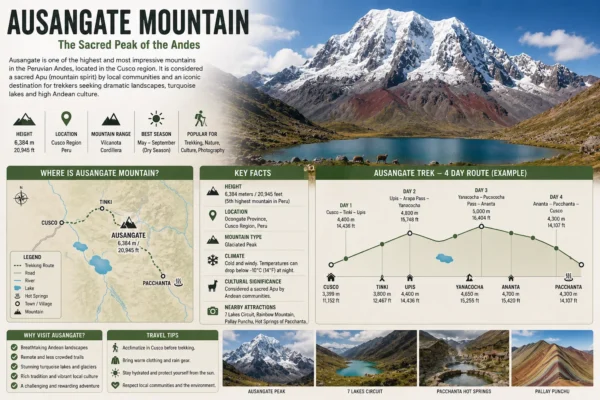
Ausangate Mountain Ausangate Mountain is one of the highest and most important mountains in…
Related Tours