
Ausangate Trek Map
An Ausangate Trek map is one of the easiest ways to understand this high-altitude route through Peru’s Vilcanota mountain range. The trail passes through remote Andean valleys, glacial lakes, mountain passes, traditional communities, and landscapes dominated by the snow-covered Ausangate Mountain.
There are several versions of the Ausangate Trek, ranging from shorter routes to longer circuits. This guide focuses on a classic 4-day Ausangate Trek route, beginning in the Tinki/Upis area and finishing around Pacchanta.
Before looking at the individual sections, remember that this is a high-altitude route. Much of the trek remains above 4,000 meters (13,123 feet), making elevation just as important as distance when reading the map.
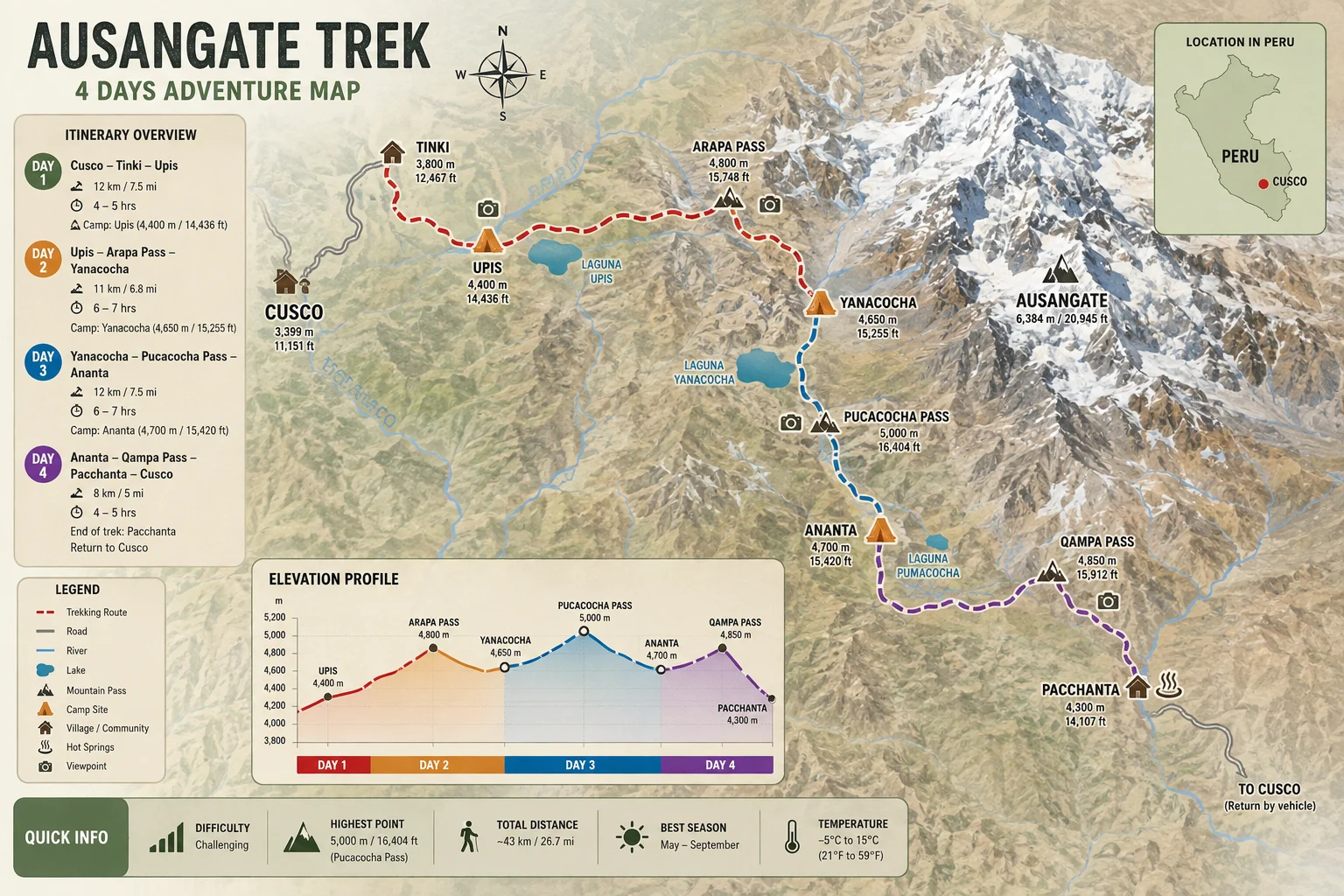
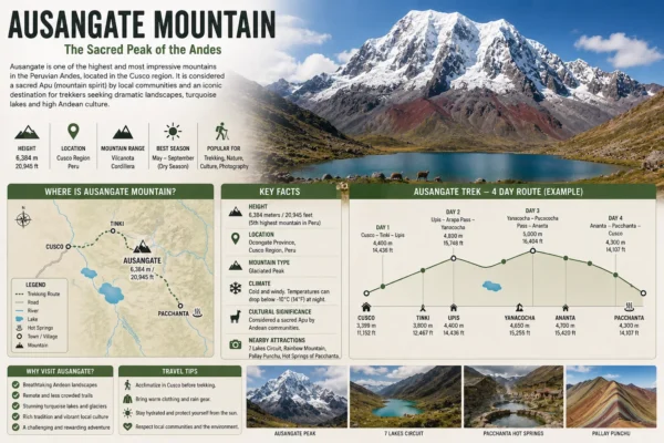
Ausangate Trek 4 Days Map
The map should show the main progression of the route:
Cusco → Tinki → Upis → Arapa Pass → Pucacocha → Ausangate Cocha → Palomani Pass → Soraycucho/Jampa area → Campa Pass → Pacchanta → Cusco
Rather than traveling directly from one attraction to another, the trail circles through the mountains surrounding Ausangate and crosses several high passes.
This is why looking at the route on a map gives a much better idea of the trek than simply reading the total distance.
Ausangate Trek Map: Main Points
| Map Point | Approx. Altitude | What You’ll Find |
|---|---|---|
| Cusco | 3,400 m / 11,155 ft | Starting city |
| Tinki | 3,800 m / 12,467 ft | Gateway to Ausangate |
| Upis | 4,400 m / 14,436 ft | Camp and mountain views |
| Arapa Pass | 4,800–4,850 m / 15,748–15,912 ft | First major high pass |
| Pucacocha | Around 4,500 m / 14,764 ft | Glacial lakes |
| Ausangate Cocha | Around 4,650 m / 15,256 ft | High-altitude campsite area |
| Palomani Pass | Approx. 5,100–5,200 m / 16,732–17,060 ft | Highest section on many routes |
| Jampa/Campa area | Around 5,000 m at the pass | Final major mountain crossing |
| Pacchanta | Around 4,200 m / 13,780 ft | Hot springs and trek finish |
Exact elevations and campsites vary slightly according to the itinerary used.
Day 1: Cusco → Tinki → Upis
The first section on the map takes you southeast from Cusco toward Tinki, one of the principal gateways to the Ausangate region.
From the trailhead area, the trek begins climbing through open puna landscapes toward Upis.
Ausangate Mountain gradually becomes the dominant feature of the landscape as you approach the first campsite.
Main map points:
Cusco → Tinki → Trailhead → Upis
Upis sits at approximately 4,400 meters and is known for its impressive position near Ausangate and access to thermal waters in the area.
The first day is important because it introduces you to the elevation that will dominate the rest of the trek.
Day 2: Upis → Arapa Pass → Pucacocha → Ausangate Cocha
The second day moves deeper into the Vilcanota mountain range.
From Upis, the trail climbs toward Arapa Pass, which reaches approximately 4,800–4,850 meters.
After crossing the pass, the route enters an impressive glacial landscape.
Main map points:
Upis → Arapa Pass → Yanacocha → Pucacocha → Ausangate Cocha
This section is particularly scenic because several glacial lakes appear beneath the Ausangate massif.
Pucacocha is one of the most recognizable areas along the route, with colorful lakes surrounded by steep mountain walls and glaciers.
By this point, you are hiking and sleeping at elevations well above 4,000 meters.
Understanding the Ausangate Trek altitude before starting the route is important because the elevation profile explains why relatively short distances can still feel demanding.
Day 3: Ausangate Cocha → Palomani Pass → Soraycucho/Jampa Area
Day 3 contains one of the most important points on the Ausangate Trek map:
Palomani Pass.
The trail climbs from the Ausangate Cocha area toward the highest section of the classic circuit.
Main map points:
Ausangate Cocha → Palomani Pass → High-Andean valleys → Soraycucho/Jampa area
Palomani reaches approximately 5,100–5,200 meters (16,732–17,060 feet) on commonly used routes.
From the pass, trekkers can see glaciers, valleys, and some of the most remote landscapes of the entire circuit.
After reaching the high point, the route begins descending toward the next campsite.
This is typically one of the most demanding sections of the route. Our Ausangate Trek Difficulty guide explains how altitude, terrain, weather, and consecutive hiking days affect the overall challenge.
Day 4: Jampa/Soraycucho → Campa Pass → Pacchanta → Cusco
The final day continues through the high Andes before beginning the longer descent toward Pacchanta.
Depending on the exact 4-day route, trekkers may cross the Campa or Jampa Pass, at approximately 5,000 meters.
Main map points:
Jampa/Soraycucho → Campa Pass → Glacial lakes → Pacchanta → Cusco
The landscape gradually changes as the trail descends.
Several routes pass close to colorful glacial lakes before reaching Pacchanta, one of the most important communities associated with the Ausangate circuit.
Pacchanta is particularly known for its natural hot springs, making it a fitting place to finish several days of high-altitude trekking.
From Pacchanta, transportation returns toward Cusco.
Ausangate Trek Elevation Profile
Looking at the map horizontally shows where you travel.
Looking at the elevation profile shows why the trek is challenging.
A simplified profile looks like this:
| Section | Elevation |
|---|---|
| Cusco | 3,400 m |
| Tinki | 3,800 m |
| Upis | 4,400 m |
| Arapa Pass | 4,800–4,850 m |
| Pucacocha area | ~4,500 m |
| Ausangate Cocha | ~4,650 m |
| Palomani Pass | ~5,100–5,200 m |
| Campa/Jampa Pass | ~5,000 m |
| Pacchanta | ~4,200 m |
The important detail is not simply reaching 5,000 meters.
The route stays high for several days.
Unlike treks that cross one major pass before descending substantially, Ausangate repeatedly moves between camps above 4,000 meters and passes approaching or exceeding 5,000 meters.
Where Does the Ausangate Trek Start?
The traditional gateway to the Ausangate region is Tinki, southeast of Cusco.
However, the exact hiking starting point varies between itineraries.
Some routes begin walking directly from areas closer to Tinki, while others use transportation to reach a trailhead closer to Upis or Pukarumi.
For this reason, two Ausangate Trek maps may look slightly different even when both represent a four-day circuit.
Where Does the Ausangate Trek End?
Many classic circuits finish around Pacchanta.
Pacchanta is located on the northern side of the Ausangate massif and is well known for its hot springs and access to the surrounding glacial lakes.
From here, trekkers normally continue by vehicle back toward Cusco.
Other Ausangate itineraries may finish elsewhere, particularly routes that incorporate Rainbow Mountain.
Is There Only One Ausangate Trek Route?
No.
This is important when using an Ausangate Trek map.
There is no single itinerary followed by every trekking company.
Common variations include:
-
4-day Ausangate Trek
-
5-day classic circuit
-
Longer Ausangate circuits
-
Ausangate + Rainbow Mountain
-
Ausangate + 7 Lakes
-
Routes beginning around Upis
-
Routes beginning around Pacchanta
Camp locations and the exact passes crossed can therefore change.
Always compare the map with the itinerary you are actually planning to hike.
Ausangate Trek 4 Days vs 5 Days
A four-day route compresses the Ausangate experience into fewer trekking days.
A five-day itinerary generally allows the distance and elevation changes to be distributed across more time.
That does not mean every five-day route is automatically easier because itineraries differ, but additional time can create a more gradual hiking schedule.
For travelers concerned about altitude or consecutive long hiking days, the daily route is often more important than simply choosing based on the total number of days.
How Difficult Is the Route on the Map?
When viewed on a map, some sections of Ausangate may not appear particularly long.
Altitude changes everything.
Walking 10 kilometers at 4,500–5,000 meters is very different from walking the same distance close to sea level.
The main challenges are:
-
Sustained high altitude
-
Multiple mountain passes
-
Consecutive hiking days
-
Remote terrain
-
Cold temperatures
-
Changing weather
This combination makes Ausangate a challenging trek even though standard routes do not normally require technical climbing.
Best Time to Follow the Ausangate Route
Trail conditions change significantly throughout the year.
The dry season generally provides more stable conditions for hiking, while the wetter months can bring rain, mud, clouds, and snow at the highest passes.
If you are choosing your trekking dates, our guide to the best time to hike the Ausangate Trek explains the route month by month.
Weather is particularly important on a route map like this because the highest sections are exposed mountain environments where conditions can change rapidly.
Preparing for the Ausangate Route
Seeing the entire route on a map can make the trek look intimidating, but preparation makes a significant difference.
Before starting, focus on:
-
Cardiovascular endurance
-
Uphill hiking
-
Leg strength
-
Acclimatization
-
Back-to-back hiking days
-
Appropriate mountain equipment
Our guide on how to prepare for the Ausangate Trek provides a practical training and acclimatization plan before traveling.
What Should You Carry?
The remote nature of the route means you should prepare your equipment before leaving Cusco.
Essential items include appropriate hiking footwear, warm layers, waterproof protection, sun protection, a daypack, trekking poles, and cold-weather equipment.
Use our Ausangate Trek Packing List to check your equipment before departure.
Can You Hike Ausangate Without a Map?
A map is useful for understanding the route, but it should not be your only navigation tool if hiking independently.
Ausangate crosses remote high-altitude terrain where weather can reduce visibility and trail intersections may not always be obvious.
Independent hikers should have appropriate navigation skills, offline maps or GPS data, and experience traveling through remote mountain environments.
Travelers joining an organized trek normally follow the route with a guide and trekking team.
Frequently Asked Questions
Where is the Ausangate Trek?
The Ausangate Trek is located in the Vilcanota mountain range southeast of Cusco, Peru, surrounding Ausangate Mountain.
How high does the Ausangate Trek go?
Depending on the route, mountain passes can reach approximately 5,000–5,200 meters (16,404–17,060 feet).
What is the highest point on the Ausangate Trek map?
On many classic circuits, Palomani Pass is the highest point, reaching approximately 5,100–5,200 meters depending on the route and mapping source.
Where does the Ausangate Trek start?
Tinki is the traditional gateway, although many itineraries use transportation to reach trailheads closer to Upis or other nearby locations.
Where does the Ausangate Trek finish?
Many classic circuits finish around Pacchanta before returning to Cusco by vehicle.
Can I download an Ausangate Trek map?
A downloadable or offline map can be useful when planning the route. Independent trekkers should use reliable GPS navigation rather than relying only on a static image.
Is the 4-day Ausangate Trek difficult?
Yes. Four-day routes are challenging because they combine high-altitude passes, consecutive hiking days, cold conditions, and remote terrain.
Final Thoughts
An Ausangate Trek map makes it much easier to understand how the route moves through the Vilcanota mountain range.
On the classic four-day circuit, trekkers travel from the Tinki and Upis area through Arapa Pass, Pucacocha, Ausangate Cocha, Palomani Pass, the Jampa/Campa area, and finally toward Pacchanta before returning to Cusco.
But the most important feature of the map is elevation.
Much of the journey remains above 4,000 meters, while the highest passes approach or exceed 5,000 meters. Understanding this elevation profile helps explain both the beauty and difficulty of the route.
Before hiking, review the Ausangate Trek altitude, Ausangate Trek difficulty, and Ausangate Trek Packing List to prepare for the conditions shown on the map.
Related Articles
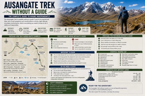
Ausangate Trek Without a Guide
Ausangate Trek Without a Guide Can you do the Ausangate Trek without a guide?…
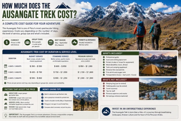
How Much Does the Ausangate Trek Cost?
How Much Does the Ausangate Trek Cost? The Ausangate Trek cost typically ranges from…
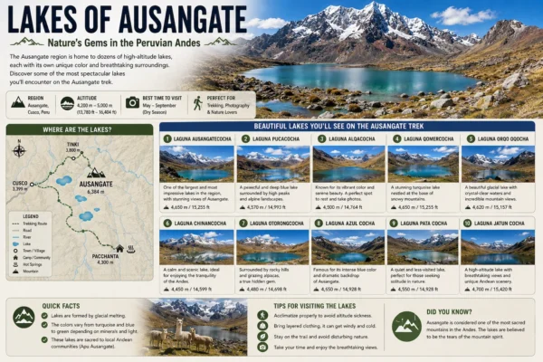
Lakes of Ausangate The Lakes of Ausangate are among the most spectacular natural features…
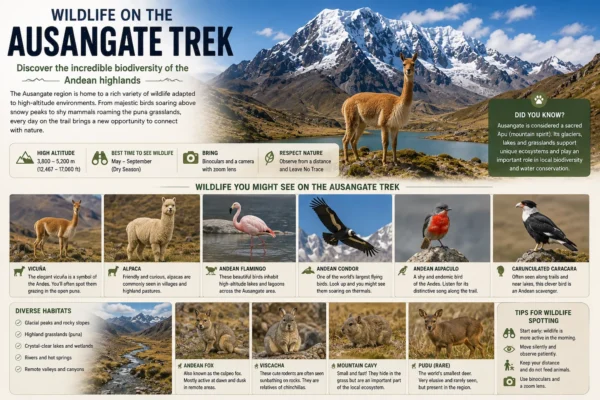
Wildlife on the Ausangate Trek
Wildlife on the Ausangate Trek The wildlife on the Ausangate Trek is adapted to…
Ausangate Mountain Ausangate Mountain is one of the highest and most important mountains in…
Related Tours