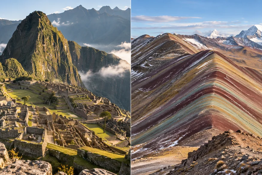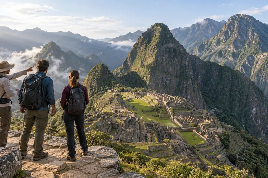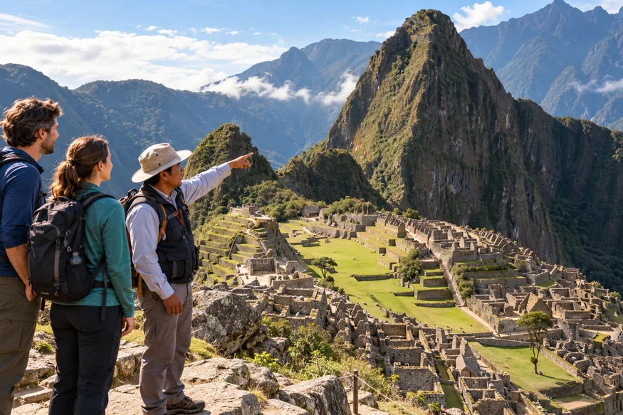

The best photo spots in Machu Picchu are determined by your ticket, not by how early you arrive or how far you are willing to wander. Visitors follow a defined one-way route, and each circuit reveals a different combination of panoramic terraces, urban architecture and mountain views.
For the broad postcard view, prioritize the elevated routes of Circuit 1 or the classic perspectives included in Circuit 2. For close architectural photographs, Circuit 2 and Circuit 3 place you nearer temples, residences and lower terraces. Mountain routes add dramatic height, but they require more time and physical effort.
Quick answer: Route 1-B is the clearest choice when the high panoramic view is your priority. Routes 2-A and 2-B provide the strongest balance of classic scenery and archaeological detail. Routes 1-A, 1-C, 3-A and 3-D add elevated perspectives through a hike, while Circuit 3 is better for intimate views from the lower part of the citadel.
Best Machu Picchu Photo Spots by Circuit
| Photo experience | Most relevant route | What it emphasizes |
|---|---|---|
| High classic panorama | 1-B Upper Terrace | Citadel, terraces and Huayna Picchu in one frame |
| Panorama plus archaeology | 2-A Designed Route | Elevated platforms and important urban sectors |
| Lower classic perspective | 2-B Lower Terrace | Terraces, architecture and mountain scale |
| Highest broad landscape | 1-A Machupicchu Mountain | Citadel as part of the wider Andes |
| Historic approach | 1-C Intipunku | Stone trail and sanctuary seen from the Sun Gate direction |
| Steep summit view | 3-A Waynapicchu Mountain | Citadel geometry viewed from above |
| Close architectural detail | 3-B Royalty Route | Fine masonry, lower terraces and sacred spaces |
The Ministry of Culture currently organizes Machu Picchu into three circuits containing ten routes. Some routes operate only in high season, and availability is limited by entry time. Always compare the official map with our Machu Picchu circuits guide before buying.
1. Upper Terrace: The Classic Machu Picchu Panorama
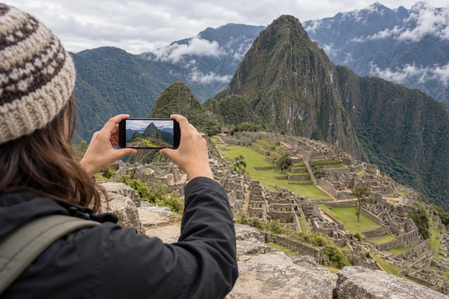
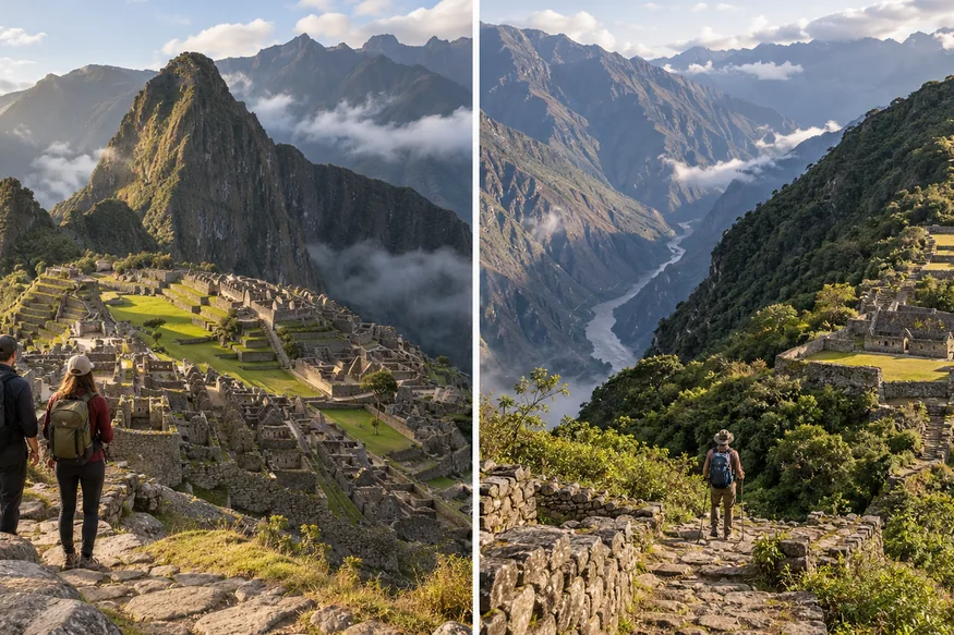
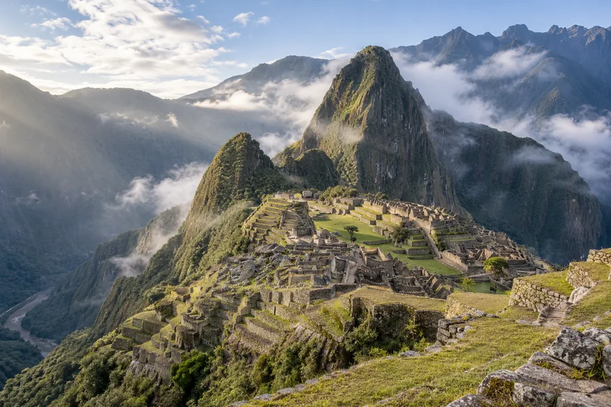
The upper agricultural terraces provide the composition most travelers recognize: green terraces descending toward the stone city, Huayna Picchu rising behind it and forested mountains enclosing the sanctuary. Elevation separates the main elements and makes the urban plan easier to understand.
Route 1-B, the Upper Terrace Route, is designed for this panoramic experience. It is an excellent choice when the wide view matters more than walking through many interior archaeological sectors. The perspective changes as you move along the designated terrace, so make a broad landscape first and then look for tighter frames that isolate the central plaza or mountain.
Cloud can hide Huayna Picchu temporarily. Do not abandon the viewpoint immediately; moving mist often opens and closes in layers. Follow staff directions and keep the path clear while waiting for a change.
2. Lower and Upper Platforms on Circuit 2
The official map for Route 2-A begins with lower and upper platforms before continuing through the city. These positions create a valuable compromise: a recognizable view of Machu Picchu followed by access to architectural areas that produce a more complete visual story.
The lower platform brings stonework and terraces closer to the foreground. The upper platform gives more separation between the citadel and surrounding mountains. Instead of copying one famous frame, use both elevations to show how the buildings fit the steep ridge.
Route 2-B follows the lower-terrace variation. It still provides a classic sense of place, but the foreground and angle differ from the highest panoramic route. This can be more interesting for travelers who want archaeology to feel present rather than distant.
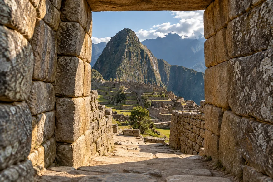
3. Temple of the Sun Viewpoint
The viewpoint above the Temple of the Sun appears on the official Route 2-A map. Here the subject is not a vast panorama but the precision of Inca architecture: curved masonry, fitted stone, adjoining structures and the changing geometry created by light.
Photograph the temple within its context rather than zooming only into one wall. A medium focal length can connect the curved building with terraces and neighboring spaces. Side light reveals stone texture, while overcast weather keeps contrast manageable.
Respect barriers and route direction. The best angle is the best permitted angle—not a position reached by leaning over masonry or leaving the path.
4. Plaza of the Temples and Intiwatana Area
Route 2-A continues through the Plaza of the Temples and the Intiwatana pyramid area. These sectors work well for photographs of ceremonial architecture, doorways, shadows and carefully cut stone. They also provide visual transitions between broad scenery and close detail.
Use walls as leading lines and wait for visitors to move naturally through the frame. A person can provide scale without dominating the subject. When the route is busy, concentrate on a corner, doorway or masonry joint rather than waiting indefinitely for a completely empty plaza.
5. Sacred Rock and the View Toward Huayna Picchu
The Sacred Rock sector creates a visual dialogue between shaped stone and the mountain landscape. The official Route 2-A map includes this sector before the path continues through other urban areas.
Keep the sacred object and surrounding setting in the frame without touching or approaching beyond the authorized route. A moderate wide-angle view shows context; a standard lens can emphasize the relationship between form, texture and ridge line.
6. Royalty Circuit: Best Lower-Citadel Photo Spots
Circuit 3 remains lower than the panoramic circuit and focuses on important spaces associated with the royal and ceremonial sector. It is not the ticket to choose solely for the elevated postcard view, but it can be excellent for architectural storytelling.
Lower terraces create strong diagonals, while passages and stone openings provide natural frames. Because the mountain appears above closer walls, images from this circuit can feel more immersive than a distant overview. This is a useful route for travelers interested in masonry, human scale and the experience of moving through the city.
If your priority is one high panorama, select the appropriate panoramic or classic route instead of assuming every ticket includes it.
7. Machu Picchu Mountain: The Widest Aerial-Like View
Route 1-A combines the panoramic circuit with the hike toward Machu Picchu Mountain. From higher sections, the citadel becomes a compact geometric form surrounded by the Urubamba canyon and layers of green ridges.
This is the strongest choice for showing the sanctuary as part of a vast landscape. It is not a drone perspective; it is earned by climbing a permitted mountain route. The citadel appears smaller, so a standard or short telephoto lens may communicate it better than an ultra-wide lens.
The hike demands time, stairs and steady pacing. Read our comparison of Huayna Picchu vs Machu Picchu Mountain and review Machu Picchu walking difficulty before choosing it for photography alone.
8. Intipunku: Machu Picchu from the Sun Gate Direction
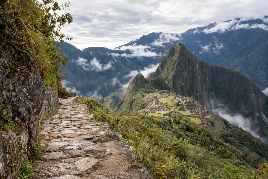
Route 1-C leads toward the Intipunku gateway and is listed by the official site as a high-season route. The view is valuable because it places the citadel within the historic approach from the Inca Trail. The stone path, terraces and distant city can form layers in the same image.
The sanctuary appears farther away than it does from the upper terrace, so this spot is about landscape and approach rather than architectural detail. Use the trail as a leading line and retain enough mountain context to communicate scale.
9. Huayna Picchu Summit View
Route 3-A adds the steep climb of Waynapicchu, commonly written Huayna Picchu. From above, the citadel’s terraces and plazas form a striking plan against the ridge. It is one of the most dramatic viewpoints, but it is not the classic front-facing panorama.
The summit area is compact and the trail includes steep, narrow stairs. Photograph efficiently, keep equipment secured and never use a restricted stabilization accessory. Weather can cover the city below, and no ticket guarantees a clear view.
Compare the visual experience with our guide to Machu Picchu vs Huayna Picchu before deciding whether the climb belongs in your visit.
10. Huchuy Picchu: A Shorter Elevated Perspective
Route 3-D adds Huchuypicchu during its official seasonal period. The climb is shorter and lower than Huayna Picchu, giving an elevated view without the same summit height. It can reveal terraces, urban geometry and the larger mountain above from a fresh angle.
Availability is limited, and the route should not be treated as a guaranteed substitute for the upper panoramic terrace. Choose it when the short mountain extension itself appeals to you.
11. Inca Bridge Route: Best for Trail and Landscape Details
Route 1-D extends from the panoramic circuit toward the Inca Bridge and is listed as seasonal. Its photographic strength is the relationship between engineered stone, cliffside trail and forested canyon—not another full view of the citadel.
Use this route to diversify a gallery with trail textures, mountain vegetation and the exposed setting. Follow all barriers and never attempt to cross a closed or protected section for a photograph.
Which Circuit Has the Best Classic Machu Picchu View?
Choose Route 1-B when the elevated classic panorama is the central goal. Choose Route 2-A when you want a recognizable overview together with a fuller passage through archaeological sectors. Route 2-B offers a lower variation with more foreground presence.
Do not rely on an old blog, ticket name or social caption. Official routes changed, and the same word “Machu Picchu” can describe very different access. Verify the route code on the ticket and read our Machu Picchu ticket guide.
What Time Is Best for Machu Picchu Viewpoints?
Morning can bring soft light and drifting cloud, while later entries may offer clearer ridges and more directional illumination. Neither time guarantees an open view. Mist can make an image more atmospheric, and midday sun can reveal the stepped geometry of the terraces even when it creates stronger contrast.
Your circuit and entry logistics matter more than chasing a theoretical perfect hour. Compare morning vs afternoon at Machu Picchu, current Machu Picchu weather patterns and expected crowd levels.
How to Photograph Each Viewpoint Respectfully
- Stay on the authorized route and photograph each sector when you reach it.
- Do not climb, sit on or touch stonework for a better angle.
- Keep narrow paths moving and share popular viewpoints.
- Leave tripods, monopods, selfie sticks and drones behind.
- Ask permission before making another visitor recognizable.
- Carry a small kit that can be secured on steep stairs.
For settings, composition and rain protection, use our separate guide to Machu Picchu photography tips. That article explains how to make the image; this guide helps you choose where the permitted route can take you.
How to Plan a Machu Picchu Tour Around Photography
Start with the route, then choose the entry time, transport and guide. A guide cannot change the circuit or guarantee empty viewpoints, but they can explain what appears along the route and help your photographs reflect the site’s history instead of only its scenery.
Tell the operator whether your priority is the classic panorama, close archaeology or a mountain hike before tickets are reserved. The Machu Picchu Day Trip from Cusco coordinates the essential journey, while our complete selection of Machu Picchu tours provides options for different schedules and comfort levels.
Choose the Route That Matches the View You Want
Share your travel dates and the type of photographs you hope to make. Our local team can help coordinate the appropriate route, entry time, transport and guiding before limited tickets sell out.
Frequently Asked Questions About Machu Picchu Photo Spots
Where is the famous Machu Picchu photo taken?
The familiar elevated composition is made from the agricultural-terrace side above the citadel, with Huayna Picchu behind it. Access depends on the route printed on your ticket.
Does every Machu Picchu circuit include the classic viewpoint?
No. Routes cover different elevations and sectors. Circuit 1 emphasizes panoramic access, Circuit 2 balances recognizable views and archaeology, and Circuit 3 stays lower and closer to royal and ceremonial areas.
Is Circuit 1 or Circuit 2 better for photos?
Circuit 1 is better when the high panorama is the priority. Circuit 2 is better for a varied collection combining classic scenery with architecture and interior sectors.
Can I visit multiple photo spots with one ticket?
You can use the viewpoints included along your selected route, but you cannot freely combine sectors from other routes. Some travelers buy separate tickets for different circuits, subject to availability and entry rules.
Can I go back to a viewpoint after passing it?
Do not assume you can. The routes are directional, and backtracking may not be permitted. Make the photographs you need without delaying visitor flow.
Which mountain has the best view of Machu Picchu?
Machu Picchu Mountain gives the widest landscape context. Huayna Picchu provides a steeper, closer overhead view of the citadel. The better choice depends on fitness and the composition you prefer.
Are Intipunku and the Inca Bridge always open?
The official route list identifies the Intipunku and Inca Bridge routes as seasonal. Check current availability on the official website before planning around either one.
Routes, seasonal operation, capacities and access conditions can change. Confirm the official route map and the exact code on your ticket before travel.