
Lakes of Ausangate
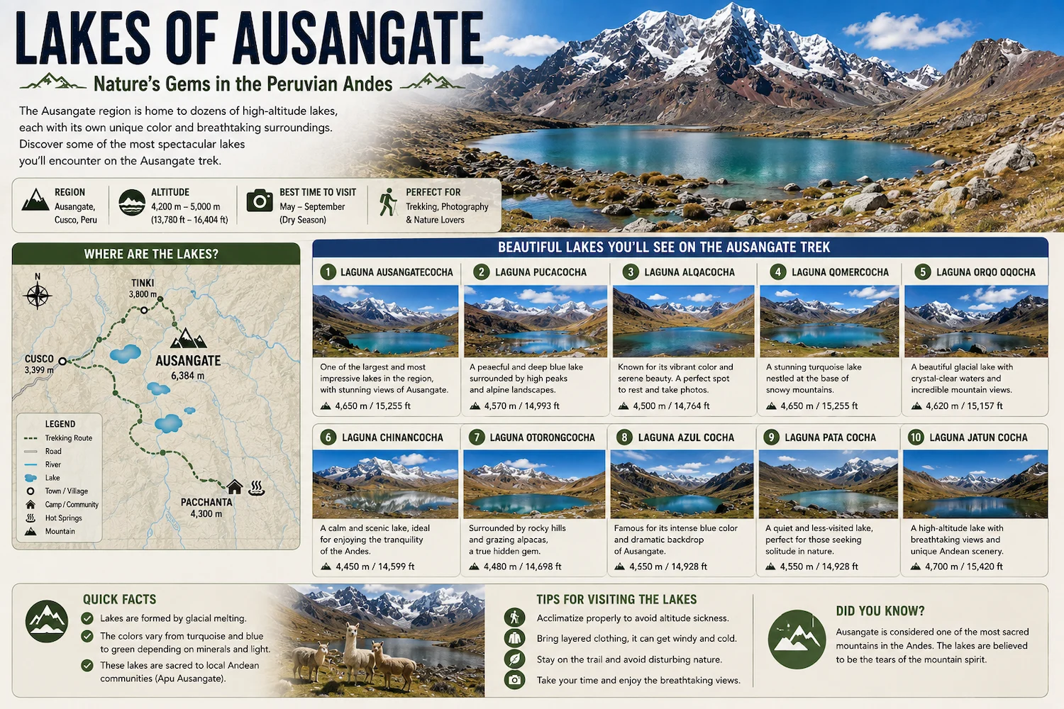
The Lakes of Ausangate are among the most spectacular natural features of the high Andes surrounding Ausangate Mountain in Cusco, Peru. Fed by glaciers and mountain streams, these high-altitude lakes appear in shades of turquoise, blue, green, and occasionally reddish tones depending on minerals, sediments, depth, and light conditions.
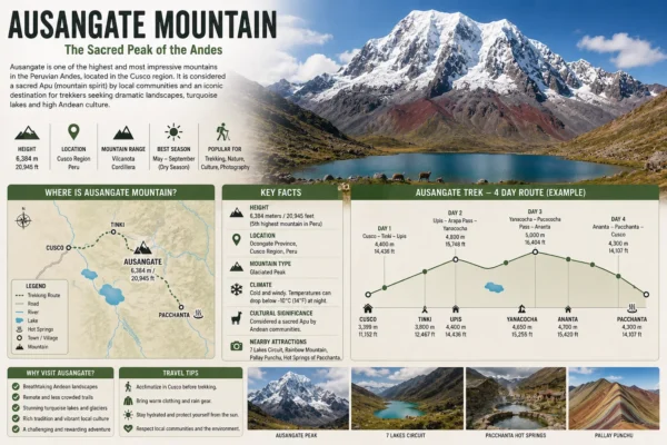
Travelers can encounter lakes throughout the multi-day Ausangate Trek, particularly around areas such as Pucacocha and Ausangate Cocha. Another popular option is the 7 Lakes of Ausangate, a separate day hike beginning near the community of Pacchanta.
Although both experiences take place around the same mountain massif, they are not exactly the same route.
Where Are the Lakes of Ausangate?
The lakes are located throughout the high-altitude valleys surrounding Ausangate Mountain in the Vilcanota mountain range southeast of Cusco.
Many lie above 4,000 meters (13,123 feet) and are surrounded by glaciers, wetlands, rocky slopes, and high-Andean grasslands.
There is no single location called “the Ausangate lakes.”
Instead, dozens of lakes are distributed throughout the massif.
Some are encountered on multi-day trekking routes, while others can be reached from communities such as Pacchanta.
Why Are There So Many Lakes Around Ausangate?
Ausangate is a heavily glaciated mountain environment.
Snow and ice from the surrounding peaks feed streams and depressions throughout the landscape, creating numerous high-altitude lakes.
Many of these are glacial lakes, formed through processes associated with past and present glacier movement.
As glaciers reshape valleys and retreat, water can accumulate behind natural rock and sediment barriers.
This explains why the landscape surrounding Ausangate contains such a high concentration of lakes.
What Color Are the Ausangate Lakes?
One of the most distinctive characteristics of the region is the variety of colors.
Depending on the lake, you may see:
-
Turquoise
-
Deep blue
-
Light blue
-
Green
-
Blue-green
-
Gray
-
Reddish or brownish tones
These colors can be influenced by several factors, including:
-
Mineral content
-
Glacial sediment
-
Water depth
-
Surrounding rock
-
Sunlight
-
Cloud cover
The same lake can even appear slightly different depending on the weather and time of day.
Main Lakes on the Ausangate Trek
The classic Ausangate circuit passes several important lake systems.
The exact lakes you encounter depend on your itinerary, but the following areas are among the best known.
Pucacocha Lakes
Pucacocha is one of the most impressive lake areas along the Ausangate Trek.
Rather than a single isolated lake, trekkers encounter a series of glacial lakes beneath dramatic mountain walls.
The contrast between the water, glaciers, and surrounding reddish-brown mountains makes this one of the most photogenic sections of the route.
Depending on your itinerary, trekkers may camp near the Pucacocha area before continuing toward higher mountain passes.
Ausangate Cocha
Ausangate Cocha, sometimes written Ausangate Qocha, is another important lake along the classic circuit.
“Qocha” or “cocha” means lake or lagoon in Quechua.
The lake sits beneath the massive Ausangate landscape at very high elevation.
For many trekkers, this section provides some of the closest and most dramatic views of the glaciers surrounding the mountain.
It can also serve as a campsite area on certain itineraries.
Yanacocha
The name Yanacocha comes from Quechua:
yana = black/dark
qocha = lake
It can therefore be interpreted as “dark lake” or “black lake.”
There are many places named Yanacocha throughout the Andes, but a lake with this name is encountered on some Ausangate trekking routes.
Its darker appearance contrasts with some of the brighter turquoise lakes found elsewhere along the circuit.
Other Glacial Lakes
Numerous smaller lakes appear throughout the Ausangate region.
Some have established local names, while others are simply encountered as part of the landscape between mountain passes.
This is one reason an Ausangate Trek Map is useful when planning the route.
It shows how the main lake systems relate to campsites, mountain passes, and the trail around the Ausangate massif.
What Are the 7 Lakes of Ausangate?
The 7 Lakes of Ausangate are a group of colorful high-altitude lakes located near Pacchanta.
They can be visited on a day hike and should not be confused with all of the lakes encountered during the multi-day Ausangate Trek.
The route is often known as:
7 Lagunas de Ausangate
or
Ausangate 7 Lakes
It has become a popular alternative for travelers who want to experience Ausangate’s glacial scenery without completing a four-, five-, or six-day trek.
Names of the 7 Lakes of Ausangate
The lakes commonly associated with the Pacchanta circuit include:
-
Pucacocha
-
Patacocha
-
Alqacocha
-
Qomercocha
-
Otorongo Macho
-
Otorongo Hembra
-
Azulcocha
Spellings can vary because many names originate from Quechua and are written differently by local communities, guides, maps, and tour operators.
Some itineraries may also identify or count nearby lakes differently.
7 Lakes of Ausangate vs Ausangate Trek Lakes
This distinction is important.
| 7 Lakes of Ausangate | Ausangate Trek Lakes |
|---|---|
| Day hike | Multi-day trek |
| Starts near Pacchanta | Multiple possible trailheads |
| Defined lake circuit | Lakes distributed along route |
| Returns to Pacchanta | Continues through mountains |
| Usually completed in one day | Usually 4–6 days |
| Hot springs nearby | Camps and mountain passes |
The 7 Lakes hike focuses specifically on visiting a concentration of lakes near Pacchanta.
The Ausangate Trek, meanwhile, travels much farther around the mountain and encounters different lake systems along the way.
Pacchanta and the Ausangate Lakes
Pacchanta is one of the most important communities for accessing the northern side of the Ausangate massif.
Located at approximately 4,200 meters (13,780 feet), the community provides access to:
-
7 Lakes hike
-
Ausangate trekking routes
-
Mountain viewpoints
-
Natural hot springs
The combination of lakes and thermal waters makes Pacchanta particularly attractive for travelers who do not have enough time for the complete Ausangate circuit.
After completing the lake hike, many visitors relax in the hot springs while looking toward the surrounding mountains.
How High Are the Lakes of Ausangate?
Most of the major lakes around Ausangate are located at very high elevation.
Depending on the route, you may encounter lakes between approximately 4,300 and 4,700+ meters (14,108–15,420+ feet).
The surrounding mountain passes can climb even higher.
This means that even a relatively short lake hike can feel physically demanding.
The Ausangate Trek altitude explains why walking at these elevations is significantly different from hiking the same distance closer to sea level.
Why Are the Lakes Turquoise?
The bright turquoise color seen in some glacial lakes is often associated with extremely fine sediment produced as glaciers grind against rock.
This material is sometimes called glacial flour.
Tiny suspended particles interact with sunlight and can create striking blue or turquoise colors.
Minerals in the surrounding geology can also influence water color.
As a result, neighboring lakes can display noticeably different shades despite being located relatively close together.
Are the Lakes Frozen?
Usually not completely during normal daytime trekking conditions, but ice can occur depending on:
-
Elevation
-
Season
-
Nighttime temperatures
-
Recent snowfall
-
Weather conditions
Temperatures around Ausangate can drop well below freezing overnight.
Thin ice may therefore appear along lake edges or on smaller bodies of water during particularly cold periods.
Can You Swim in the Ausangate Lakes?
Swimming is generally not recommended.
These are extremely cold high-altitude glacial lakes.
Water temperatures can be very low, and remote locations mean emergency assistance is limited.
Some lakes may also hold cultural significance for local communities.
Visitors should respect local guidance and avoid entering lakes unless explicitly permitted.
If you want to enter warm water in the Ausangate region, the natural hot springs around Pacchanta are a much more appropriate option.
Wildlife Around the Lakes
The lakes and wetlands create important habitat within an otherwise harsh high-altitude environment.
Trekkers may encounter:
-
Andean geese
-
Ducks
-
Andean gulls
-
Giant coots
-
Other high-altitude birds
Rocky areas surrounding the lakes may also provide habitat for vizcachas.
Open grasslands farther from the water can contain alpaca herds and occasionally wild vicuñas.
Our guide to Wildlife on the Ausangate Trek covers the animals you may encounter throughout the region.
Best Time to See the Ausangate Lakes
The lakes can be visited throughout much of the year, but weather conditions change significantly between seasons.
May to September
This is generally the driest period.
Advantages include:
-
Lower probability of rain
-
Clearer mountain views
-
Drier trails
-
Better visibility
However, nights and early mornings can be extremely cold.
October to April
These months bring more precipitation.
The landscape becomes greener, but trekkers may encounter:
-
Rain
-
Snow
-
Hail
-
Clouds
-
Muddy trails
-
Reduced mountain visibility
The best time to hike the Ausangate Trek guide provides a more detailed month-by-month comparison.
Are the Lakes Better During the Dry or Rainy Season?
For most travelers, the dry season provides easier conditions.
Clear skies also increase the chances of seeing the snow-covered mountains reflected in calm lake water.
However, the rainy season can produce greener landscapes and dramatic cloud formations.
Photography conditions therefore depend on what type of scenery you prefer.
Regardless of season, mountain weather can change quickly.
Photography at the Ausangate Lakes
The lakes are among the best photography locations on the Ausangate route.
Some of the most interesting compositions include:
turquoise lake + glacier + Ausangate Mountain
or
alpacas + lake + snow-covered peaks
Early morning and late afternoon light can create softer colors and stronger reflections when wind conditions are calm.
If you carry camera equipment, remember that additional weight becomes more noticeable above 4,000 meters.
Do You See Lakes on the 4-Day Ausangate Trek?
Yes.
Most four-day Ausangate routes encounter several glacial lakes, although the exact locations depend on the itinerary.
Routes passing through the Pucacocha area provide particularly impressive lake scenery.
Because four-day routes vary considerably, always check the itinerary rather than assuming every trek visits the same lakes.
Do You See More Lakes on the 5-Day Trek?
Potentially.
A longer route can cover a larger portion of the Ausangate circuit and therefore pass additional lakes.
However, this depends on the itinerary.
Our comparison of the Ausangate Trek 4 Days vs 5 Days explains how the routes differ in distance, pace, and locations visited.
How Difficult Is Hiking to the Lakes?
Difficulty depends on which lakes you are visiting.
The 7 Lakes route from Pacchanta is a day hike, while reaching lakes such as Pucacocha as part of the classic circuit requires multi-day trekking.
The main challenge is altitude.
Even when the trail is not technically difficult, walking above 4,500 meters can make uphill sections considerably more demanding.
If you are planning the full circuit, review the Ausangate Trek Difficulty before deciding which route is appropriate.
What to Bring
Conditions around the lakes can change rapidly.
Useful equipment includes:
-
Hiking shoes or boots
-
Warm layers
-
Waterproof jacket
-
Sun hat
-
Sunglasses
-
Sunscreen
-
Gloves
-
Water
-
Snacks
-
Camera
-
Trekking poles
Multi-day trekkers will require considerably more equipment.
Use our Ausangate Trek Packing List if you are preparing for the complete circuit.
Frequently Asked Questions
How many lakes are there around Ausangate?
There are numerous glacial lakes throughout the Ausangate massif. The famous “7 Lakes of Ausangate” refers specifically to a day-hiking circuit near Pacchanta rather than the total number of lakes in the region.
Where are the 7 Lakes of Ausangate?
The 7 Lakes are located near Pacchanta, southeast of Cusco in the Ausangate region.
Are the 7 Lakes part of the Ausangate Trek?
They are located within the same broader mountain region, but the standard 7 Lakes hike is a separate day route from Pacchanta. Multi-day Ausangate itineraries may pass other lakes.
Why are the Ausangate lakes different colors?
Glacial sediment, minerals, water depth, surrounding geology, and sunlight can all influence the appearance of the lakes.
How high are the Ausangate lakes?
Many are located above 4,300 meters (14,108 feet), with some trekking routes passing lakes at considerably higher elevations.
Can you swim in the Ausangate lakes?
Swimming is generally not recommended because the lakes are extremely cold, remote, and may have cultural significance for local communities.
Can you visit the Ausangate lakes in one day?
Yes. The 7 Lakes of Ausangate near Pacchanta can be visited as a day excursion. The lakes along the classic Ausangate circuit require a multi-day trek.
Do you need to acclimatize?
Yes. The lakes are located at significant elevation. Travelers arriving from low altitude should spend time acclimatizing in Cusco or the surrounding region before attempting demanding hikes.
Final Thoughts
The Lakes of Ausangate are one of the defining features of the mountain landscape southeast of Cusco.
Glaciers surrounding the 6,384-meter Ausangate massif feed dozens of lakes that appear in shades of turquoise, blue, green, and occasionally darker mineral tones.
Travelers completing the multi-day circuit can encounter spectacular lake systems around Pucacocha and Ausangate Cocha, while those with limited time can explore the 7 Lakes of Ausangate from Pacchanta.
Both experiences offer a different perspective of the same high-Andean environment.
If you are planning a longer trek, use the Ausangate Trek Map to see where the major lakes appear along the route and check the Ausangate Trek Distance to compare the different itinerary options.
Related Articles
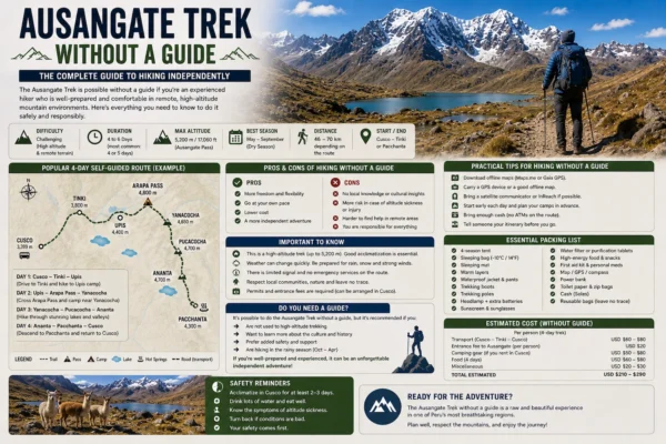
Ausangate Trek Without a Guide
Ausangate Trek Without a Guide Can you do the Ausangate Trek without a guide?…
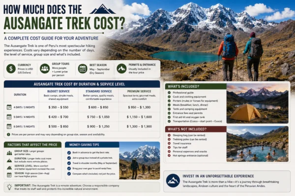
How Much Does the Ausangate Trek Cost?
How Much Does the Ausangate Trek Cost? The Ausangate Trek cost typically ranges from…
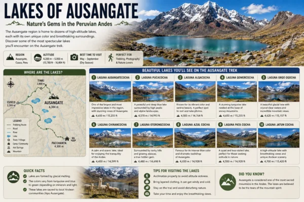
Lakes of Ausangate The Lakes of Ausangate are among the most spectacular natural features…
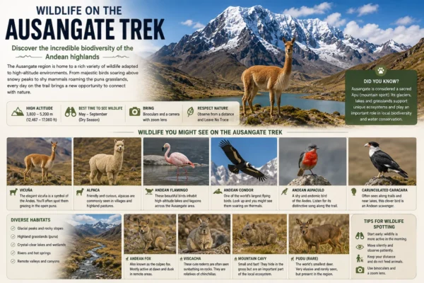
Wildlife on the Ausangate Trek
Wildlife on the Ausangate Trek The wildlife on the Ausangate Trek is adapted to…
Ausangate Mountain Ausangate Mountain is one of the highest and most important mountains in…
Related Tours